UN
2 Mere Road
£ 135,000
Description
We don't have a Description for this property.
- Bedrooms
- 3
- Bathrooms
- 0
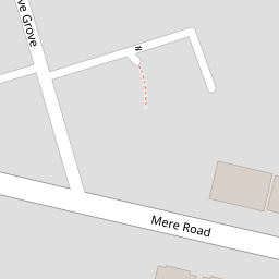
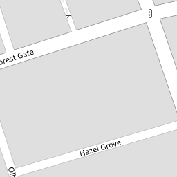

Leaflet © OpenStreetMap contributors
The heatmap indicates the level of crime in the area. The color of the heatmap indicates the crime severity and recency.
Metrics Year-on-Year
- Average area value
- 216,667.00 £Increased by 72.04 %
- Average area rental value
- 790.00 £/moIncreased by 4.64 %
- Est rental Yield
- 4.38 %Decreased by 39.08 %
- Crime Rate
- 7.00 %Unchanged by 0.00 %
from 125,939.00 £
from 755.00 £/mo
from 7.19 %
from 7.00 %
Nearby Schools
| Name | Type | Ofsted | Distance |
|---|---|---|---|
| St Kentigern'S Catholic Primary School | Voluntary Aided School | Good | 0.31 KM |
| Woodlands School | Community Special School | Good | 0.49 KM |
| Park Community Academy | Academy Special Converter | Outstanding | 0.55 KM |
| The Together Centre | Children's Centre Linked Site | 0.60 KM | |
| Devonshire Primary Academy | Academy Converter | Requires improvement | 0.75 KM |
Images
Nearby Streets
| Name | Average Price | Average Sqft | Distance |
|---|---|---|---|
| Myrtle Avenue | £ 0 | 0 | 0.00 KM |
| Hillside Close | £ 0 | 0 | 0.00 KM |
| Springfield Court | £ 99,950 | 0 | 0.00 KM |
| Palatine Road | £ 124,142 | 0 | 0.00 KM |
| North Square | £ 0 | 0 | 0.00 KM |
Nearby Transport
| Name | NLC | TLC | Distance |
|---|---|---|---|
| Blackpool North | 2739 | BPN | 1.84 KM |
| Layton (Lancs) | 2669 | LAY | 2.13 KM |
| Blackpool South | 2740 | BPS | 2.60 KM |
| Blackpool Pleasure Beach | 2738 | BPB | 3.88 KM |
| Squires Gate | 2666 | SQU | 4.73 KM |
Nearby Listings
| Address | Price | Type | Score | Distance |
|---|---|---|---|---|
| Newcastle Avenue, Blackpool, Lancashire, FY3 | £ 105,000 | BUY | Unknown | 0.09 KM |
| Hazel Grove, Blackpool | £ 165,000 | BUY | Unknown | 0.09 KM |
| Mere Road, Blackpool | £ 190,000 | BUY | 6 / 10 | 0.14 KM |
| Forest Gate, Blackpool, Lancashire, FY3 9AP | £ 45,000 | BUY | 5 / 10 | 0.15 KM |
| Forest Gate, Blackpool | £ 185,000 | BUY | Unknown | 0.15 KM |
Nearby Properties
| Address | Price | Distance |
|---|---|---|
| 22 Mere Road | £ 176,500 | 0.00 KM |
| 4 Mere Road | £ 120,000 | 0.00 KM |
| 12 Mere Road | £ 128,000 | 0.00 KM |
| 16 Mere Road | £ 185,000 | 0.00 KM |
| 2 Mere Road | £ 135,000 | 0.00 KM |